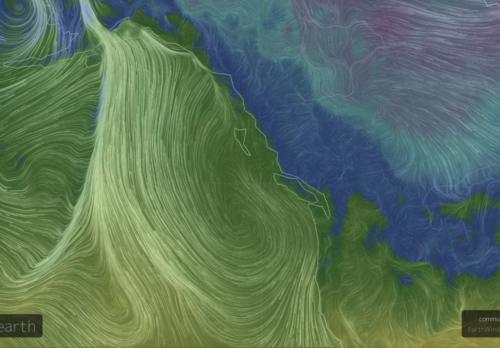
Look at a map of the earth from space. Find where you live, your watershed, your bioregion…. sit and look at it… what shapes do you notice? what features? How does that impact or change where you live (the wind, the rain, the soil…. the animals or forests)?
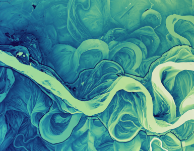
Cascadia is a bioregion. It is defined through the watersheds that flow into the north eastern Pacific Rim. Digging just a little bit deeper – it means an area defined through the hard fissures of rock and stone of the plate tectonics that have created the ring of fire and Cascade mountains – from which Cascadia takes its name, and how the land and rivers have been shaped through millions of years of wind, of rain and erosion.
Bioregions, unlike the ecoregions within them, are often defined through hard edges. Jagged fissures, subduction zones. Cataclysmic rising and falling of volcanoes, and magma, and mountain ranges. Hard edges and tectonic plates. Ecoregions, the rooms in the house, can be hard, or soft, as they blur from area to area.
Cascadia has many hard edges
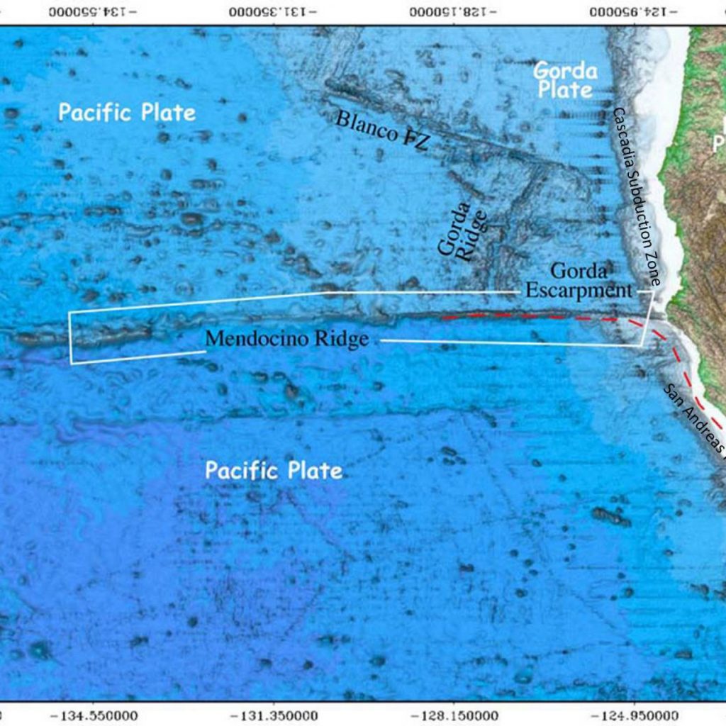
- In the south, the Cascadia bioregion stretches from to the Mendocino ridge, a massive escarpment where the Cascadia Subduction Zone meets the San Andreas fault.
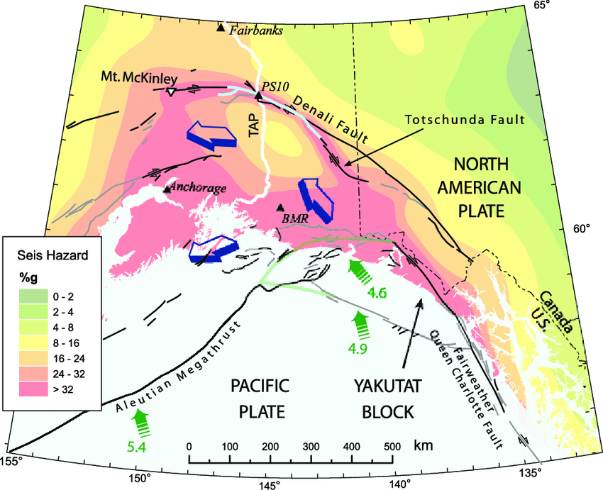
- In the North, Cascadia reaches to the Yasʼéitʼaa Shaa in the north, the meeting of several fracture zones, and a place where different plates are jamming into each other with tremendous force.
- To the west, Cascadia extends for many miles off the coast, to the subduction zone where old earth is being recycled deep into the mantle, uplifting continents and generating incredible energies that extend to the other end of the bioregion –
- In the east, the Yellowstone Caldera, from whose last eruption, combined with incredible glacial floods, drought, fires and rain have shaped much of the landscape that our watersheds now tread.

From this, the wind and rain and energy which flow through, shaped and shaping the natural environment, giving rise to different species of plants, forests and fauna. Geology is a layer, watersheds are layers, wind and rain are layers. Salmon are a layer. And of course human inhabitation, both settler and indigenous (how we shape our environments around us)… Layer after layer, all making Cascadia the amazing bioregion that we call home.
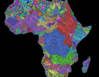
Mapping bioregions is not a process of drawing lines on paper, rather it is to sit back, and layer, information over layer of information, until our bioregions, ecoregions and the natural building blocks of the world emerge. From these, we can establish bioregional frameworks, methods for accountability and responsibility which guide our administrative units, our societal and personal choices, and cultures.
Below is a beautiful image that David McCloskey, who has been mapping Cascadia for more than 40 years shared recently via email that helps visualize how our bioregions emerge through wind – the idea of flows, and how these flows shape rainfall, erosion, soil, the flora and fauna that grow from them.